This guide begins at the south parking area at Black Point
There are two trails from this parking lot. At the end of the parking lot, between the two pillars, is the Windswept Trail. This trail leads to the Windswept ruins with a branch trail leading to Scarborough State Beach. Quahog Rock Trail, to the left of Windswept trail leads across to the ocean and Quahog Rock. This trail guide will take the Windswept Trail and connect with the Malcolm Grant (MG)Trail which follows the coast and ends up at the main parking lot.
After a short walk on the Windswept Trail is a fork in the trail. The left fork passes between a couple of stone columns and leads to the Windswept ruins and the MG Trail. The right fork continues to the beach.
As you approach the intersection with the Malcolm Grant trail, ruins can be seen on the right. This was the Carriage house for the Windswept estate. Figure 1
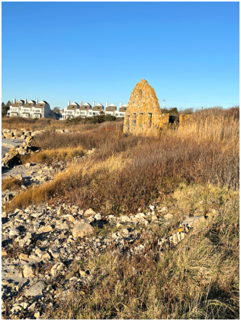
Figure 1. Windswept carriage house ruins
Straight ahead is the mile long Scarborough State Beach. Seaweed tends to wash up in the corner and this section is known as Stinky Beach. The seaweed is a popular feeding spot for migrating shorebirds in the spring or late summer.
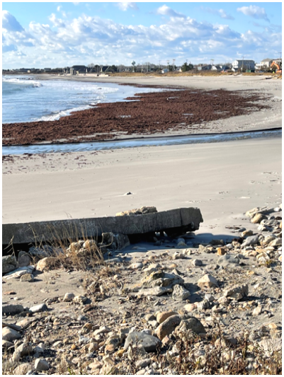
Figure 2. Stinky Beach
Nothing remains of the 21 room, 5 bedroom mansion which stood in an open area on the left, where you can see some stone walls and stone posts and a telephone pole. A trail from the mansion site leads north between the two stone posts, splits, and both splits end up at Quahog Rock Trail. More information on Windswept is available at this website: https://www.sandhillcovephoto.com/page/windswept/#/page/windswept/
Continuing east on the MG trail, after a couple hundred yards you will soon see Quahog Rock, which projects out into the ocean, Figure 3 below. Quahog Rock is a protrusion of the bedrock, which in this area is Narragansett Pier/Westerly Granite. This granite formed 275 million years ago (Permian Age) in a magma chamber that was 15-20 km below the surface. The minerals in the granite include potassium feldspar, white plagioclase, smoky quartz, garnet, muscovite, biotite and magnetite.
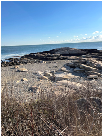
Figure 3. Quahog Rock
Just a few yards further along the trail is another trail on the left. This is the Quahog Rock trail which leads back to the south parking lot.
Further along the trail is a cross put there in memory of Erica Lee Knowles. Erica was a 23-year-old URI student who was killed in a drunk driver accident. The cross has an interesting story in that it disappeared and was found on a beach in Orient Point in Long Island, NY. The story is described in this link. https://turnto10.com/news/local/family-gets-missing-memorial-cross-back-call-it-a-christmas-miracle
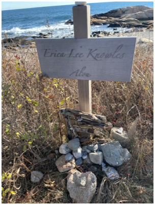
Figure 4.
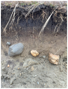
If you step off the trail near the Erica Lee Knowles cross and look back at the bank, you will see a dirt bank which is being eroded by high waves. You will also see rounded rocks on the bank face. These rocks have been buried here for about 20,000 years. This chaotic mixture of soil, sand, gravel and rocks is called till. The distinguishing characteristic of till is that the material is unsorted. The sorting process is done by water and is ongoing. If you look behind you towards the water you will see rocks, gravel and sand. In storms, the waves come in and erode the bank. The fine grained clay and silt are washed away leaving the rocks, gravel and sand. This bank is part of the Pt. Judith Moraine, mentioned above, which extends down to the Pt. Judith Lighthouse.
A little ways further on the trail, at a little bend in the trail, is a little path and just back to the left of the path is a large boulder (Figure 5). This is a glacial erratic and it is different from the bedrock in the area. That’s because it was brought here by glaciers. During the Late Wisconsin glaciation, which culminated 26,000 years ago, glaciers advanced from the north to the south and picked up, transported and deposited glacial material in Rhode Island. Large boulders, called erratics, can be found in the Black Point area.
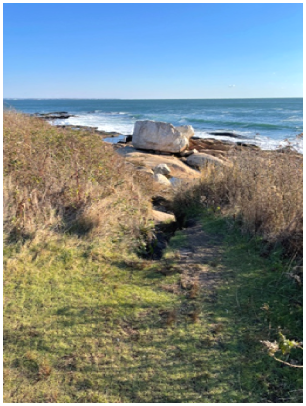
Figure 5
It’s not visible from the path, but this erratic has been split in two, as can be seen in Figure 6. Water in a crack freezing in the winter or salt from the salt water crystallizing can create pressure that will eventually crack the rock.
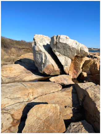
Figure 6
Further down the trail, at a turn where the trail goes up hill, is a path on the right that goes onto a larger area of exposed Narragansett Pier/Westerly Granite bedrock. You can see a variety of textures (grain sizes) in the minerals. The texture was controlled by the volatile content in the magma. Water-rich magmas have rapid crystal growth and large crystals whereas drier magmas have fine-grain crystallization. You can come up with a chronological sequence by looking at the textures. In some areas of Black Point medium-grained granite is cut by a younger coarse-grained pegmatite (see Figure 7 below)
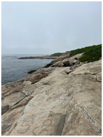
Figure 7. (Photo by Crystal Gryszkiewicz)
These cracks in the rocks (see Figure 8) that are either joints (a fracture where there is no relative displacement of the rocks on either side) or faults (where there is relative displacement along the fracture). The joints are due to unroofing. When the material above the magma chamber (the the Rhode Island Formation) was removed, the rock expanded and cracked.
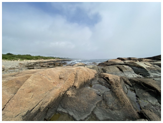
Figure 8 (Photo by Jacob Schlapfer)
Back on the MG trail, up the hill and to the right is a path to the right. This leads to a nice observation spot overlooking the ocean. This is a good place to check for wintering waterfowl, such as loons, scoters, harlequin and eider ducks and mergansers. Last winter there was a king eider, shown below, which is not too common in this area.
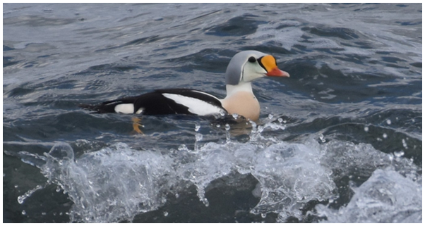
Figure 9 King Eider
Further on there is a 4-way intersection. There is a somewhat difficult but manageable descent to the right. At the bottom, more of the Narragansett Pier/Westerly Granite bedrock is exposed ahead and in both directions. Just to the left is another large glacial erratic, shown in Figures 10 & 11.
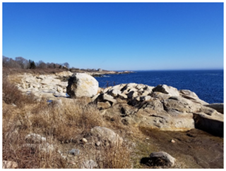
Figure 10. Glacial Erratic (Photo by Phil Dusky)
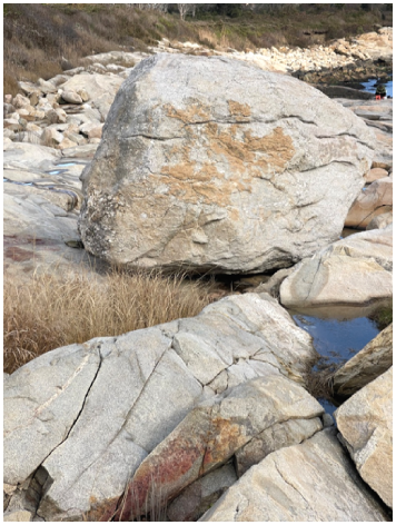
Figure 11. Close-up of Glacial Erratic
Back on the MG trail is a 4-way intersection. The trail on the left is Loop Trail which makes a loop through a wooded area with larger trees which should make it good for birding during spring migration. This trail returns to the MG trail near the main parking lot.
From the main parking lot it will be necessary to walk along Ocean Rd to get back to your starting point at the south parking area.
Hope you enjoyed your walk. Thanks to O. Don Hermes and Beth Laliberte, URI Geosciences Department for help with the geology information.